- Kia Ora
TONGARIRO ALPINE
CROSSING
It’s been described as “The best one day hike in NZ”
Fire Status Update: Great News – the Crossing is Open. Click here for full details.
Click here to book your carpark and shuttle.
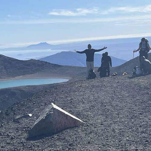
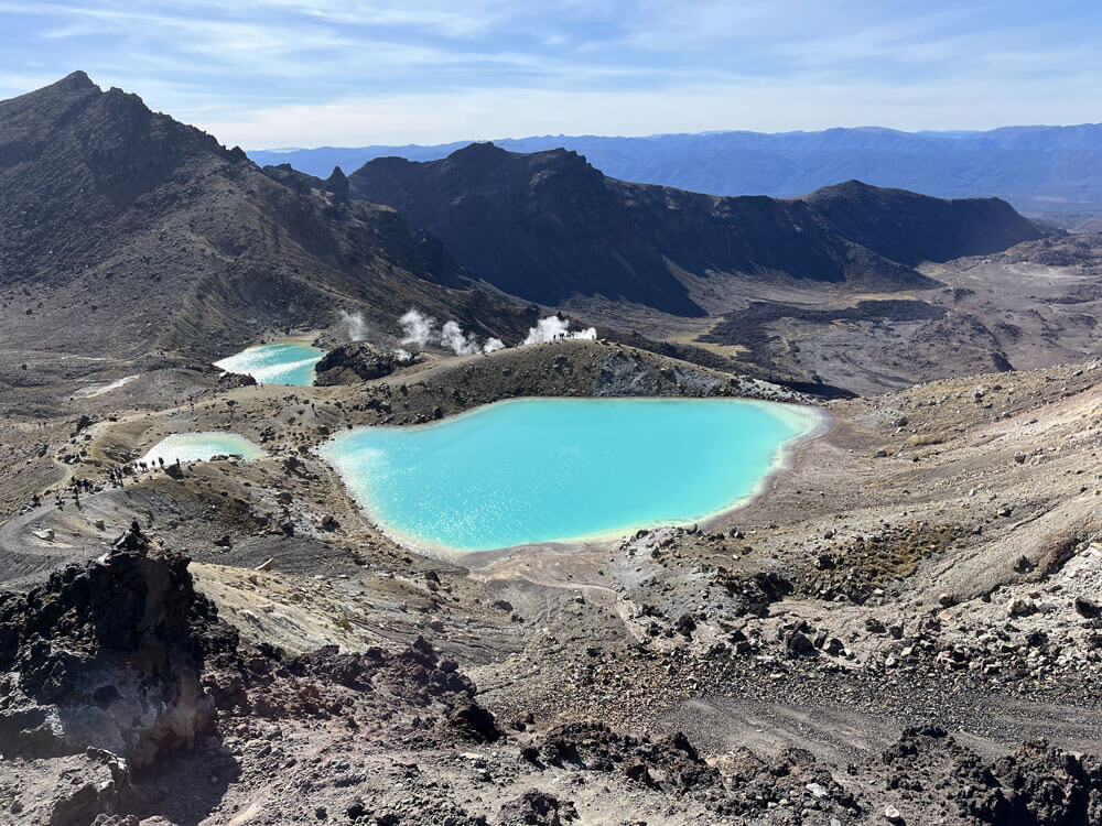
The Tongariro Crossing is an incredibly popular hiking experience for people from all over the world due to its incredible mountain beauty, stunning views, and turquoise lakes. This 20.2 km one-way track offers a life-changing journey through some of New Zealand’s most beautiful and dramatic landscapes.
- discover the Maunga
Plan Your Tongariro Crossing

Travel
Everything you need to know about hiking the Tongariro Crossing – this is the ultimate guide to help you prepare for an unforgettable adventure.
Do I need to book to do the Tongariro Crossing?
Yes, you will need to book the Tongariro Crossing in advance, especially during the peak season. This is crucial for managing visitor numbers and preserving the natural environment. Click here for all the details about booking the Tongariro Crossing.
- Hidden Places
About Tongariro National Park
Voyage
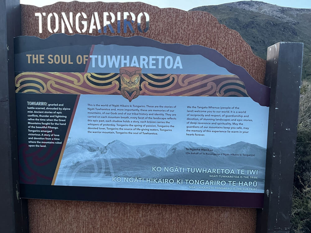
The Crossing is part of Tongariro National Park, New Zealand’s oldest national park and a UNESCO World Heritage site.
It holds spiritual and cultural significance to Ngāti Hikairo ki Tongariro hapu (sub-tribe), Ngati Tuwharetoa iwi (tribe) and all New Zealanders with its World Heritage status recognizing both the Maori cultural significance and its unique volcanic features.
- Home to three active volcanic mountains – Tongariro, Ngauruhoe, and Ruapehu
- Experience majestic landscapes, ancient lava flows, vivid crater lakes, and alpine meadows
- Received World Heritage status in 1990 for its natural and cultural values
- Ngauruhoe gained global fame as Mount Doom in the Lord of the Rings movies
- This is New Zealand's most popular day hike

- national park
About Tongariro
National Park
Voyage
Tongariro Alpine Crossing: Quick Facts
Distance
20.2 km
one way
Time Needed
6-8 hours in summer, 8-9 hours in winter
Location
Tongariro National Park, central North Island
Starts
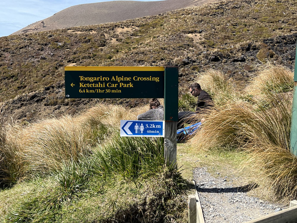
Mangatepopo Car Park (accessed via Mangatepōpō Road)
Ends
Ketetahi Car Park (on Ketetahi Road)
Elevation Gain
Approximately 765 metres (2,510 feet)
Highest Point
Red Crater summit, 1,868 metres (6,129 feet)
Fun Fact #1: The Tongariro Crossing’s official distance changed in 2024 from 19.4 km to 20.2 km due to track modifications aimed at improving safety and sustainability.
Fun Fact #2: While it’s possible to hike in the opposite direction (Ketetahi to Mangatepopo), it’s not recommended. This reverse route involves an extra 360 metres of climbing, walking against the flow of traffic, and navigating uphill over loose rocks – making it a more challenging and potentially hazardous experience.
How long does it take to walk Tongariro Crossing?
Allow 6-8 hours to complete the Tongariro Crossing in summer, and 8-9 hours in winter. The walk is 20.2 km in length, divided into 6 main sections:
- Mangatepopo Car Park to Soda Springs: 1.5 hours
- A gradual climb through scrubland and along boardwalks
- Soda Springs to South Crater: 1 hour
- Steep ascent known as the “Devil’s Staircase”
- South Crater to Red Crater: 1 hour
- Crossing the flat expanse of South Crater before a challenging climb
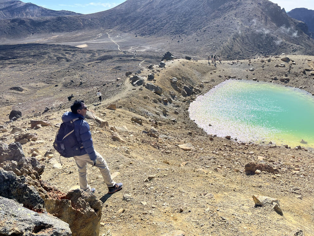
- Red Crater to Blue Lake – Te Wai Whakaata: 30 minutes
- Descent over loose scoria, passing the vivid Emerald Lakes
- Blue Lake to Ketetahi Hut: 1 hour
- Relatively flat section with panoramic views
- Ketetahi Hut to Ketetahi Car Park: 2 hours
- Long descent through changing vegetation zones
It’s crucial to take your time and enjoy the breathtaking views along the way. The alpine environment offers spectacular vistas that can make you feel like you’re on another planet. Remember, the Tongariro Crossing car park closes at 7 pm, so there’s no need to rush your experience.
The Tongariro Alpine Crossing is challenging but achievable for those with a good level of fitness. You’ll need to be prepared for:
- Walking 20.2 kilometres in a 6-8 hour period
- Ascending 765 metres (2,510 feet) in altitude
- Navigating varied terrain, including loose scoria, boardwalks, and a steep descent
- Carrying approximately 5 kilograms of gear (food, water, clothing, and safety equipment)
- Potential exposure to extreme weather conditions, even in summer
While thousands of ‘average’ people complete the crossing each year, it’s essential to prepare adequately. Consider practice hikes with a loaded backpack, including both uphill and downhill sections, to build your stamina and familiarise yourself with the demands of the trek.
How difficult is the Tongariro Crossing?
PARKING AND TRANSPORT
Your hike starts and ends at different locations – so it’s crucial to plan your carpark and Tongariro Crossing shuttle transport well in advance.
ACCOMMODATION
Where should you stay while walking the crossing? There are a few factors involved in finding the town that’s best for you.
frequently asked questions
Planning your adventure on the Tongariro Alpine Crossing? We’ve compiled the most common questions to help you prepare for an unforgettable experience.
How much does it cost to hike the Tongariro Crossing
The Tongariro Crossing itself is free to walk, but there are associated costs to consider:
- Car parking fees (varies depending on location and duration)
- Shuttle services (essential for this one-way hike)
- Any gear you may need to purchase or rent
It’s crucial to book comprehensive shuttle services in advance, especially during the busy summer hiking season. These services will transport you either to the start point or from the endpoint of your hike, ensuring you can complete the one-way track without logistical issues.
Tongariro Crossing or Tongariro Alpine Crossing?
Until 2007, this iconic hike was known simply as the “Tongariro Crossing”. The name was changed to “Tongariro Alpine Crossing” to emphasise the alpine nature of the terrain and the extreme weather conditions that can be experienced, especially during the winter season.
This name change serves as a reminder to hikers that they’re entering an alpine environment that demands respect and proper preparation. It underscores the need for appropriate gear, fitness levels, and an understanding of the potential risks involved in alpine hiking.
Why is the Tongariro Alpine Crossing So Popular?
The Tongariro Alpine Crossing has gained international recognition for several compelling reasons:
- Unique Volcanic Landscape: The crossing offers an opportunity to walk through an active volcanic area, with steam vents, old lava flows, and volcanic peaks creating an otherworldly atmosphere.
- Stunning Natural Beauty: From the vibrant Emerald Lakes to the expansive views from the Red Crater, the crossing is a visual feast. The brilliant colours of the lakes, contrasted with the stark volcanic terrain, create unforgettable vistas.
- Achievable Challenge: While demanding, the crossing is accessible to reasonably fit hikers, offering a sense of accomplishment without requiring technical climbing skills.
- Lord of the Rings Connection: Mount Ngauruhoe’s role as Mount Doom in the films has drawn fans from around the world.
- Convenient Location: Situated in the central North Island, the crossing is easily accessible from major cities like Auckland and Wellington, as well as the popular tourist town of Taupo.
- Cultural Significance: The area holds deep cultural importance for local Māori, adding a layer of historical and spiritual significance to the journey.
- Diverse Ecosystems: Hikers pass through various ecological zones, from alpine herbs to lush forests, showcasing New Zealand’s biodiversity.
How hard is the Crossing?
The Tongariro Crossing features diverse surfaces and terrain that challenge and enchant hikers:
- Well-maintained boardwalks and steps in some sections
- Loose scoria (volcanic rock fragments) on steeper parts
- Damp, spongy areas in alpine meadows
- Solid volcanic rock formations
- Dusty trails through tussock grasslands
Key challenges include:
- Uphill sections – ascending nearly 800 metres in total
- The steep climb to Red Crater, often considered the most challenging part
- Downhill sections – particularly the descent from Red Crater to Emerald Lakes, which can be slippery due to loose scoria
- Exposed ridgelines that may require careful footing, especially in windy conditions
The varied terrain adds to the adventure but also requires proper footwear and attention to your surroundings throughout the hike. Learn about the different sections of the Tongariro Crossing here
What is the Tongariro Northern Circuit?
For those seeking a multi-day adventure, consider the Tongariro Northern Circuit:
- A 3-4 day hike that encircles Mount Ngauruhoe
- Begins with the Tongariro Crossing route
- Requires booking Department of Conservation (DOC) huts in advance for peak season (late October to late April)
- DOC hut ticket or annual hut pass needed outside peak times
- Offers a more immersive experience of the park’s diverse landscapes
The Northern Circuit provides a deeper exploration of the area’s volcanic wonders and a chance to experience the changing moods of the mountains over several days.
View a comprehensive list of FAQs here.
- EXPERIENCES
OTHER APSECTS TO CONSIDER
jOURNEY

- good to know
jOURNEY
OTHER ASPECTS TO CONSIDER
Fitness Levels
A moderate level of fitness is required for the Alpine Crossing Tongariro – thousands of ‘average’ people walk the crossing every year and you do not need to be in top physical shape..
That said, it’s recommended that you ‘practice’ by going on long walks in your hometown as preparation for your hike.
This includes walking downhill, which presents its own set of challenges.
Even better, do all of this with a loaded backpack.
Remember – it’s 20.2 kilometres in length, so you’ll need to be sure you can walk that far on the day
The Terrain
The Tongariro Crossing features diverse surfaces and terrain that challenge and enchant hikers:
- Well-maintained boardwalks and steps in some sections
- Loose scoria (volcanic rock fragments) on steeper parts
- Damp, spongy areas in alpine meadows
- Solid volcanic rock formations
- Dusty trails through tussock grasslands
Key challenges include:
- Uphill sections – ascending nearly 800 metres in total
- The steep climb to Red Crater, often considered the most challenging part
- Downhill sections – particularly the descent from Red Crater to Emerald Lakes, which can be slippery due to loose scoria
- Exposed ridgelines that may require careful footing, especially in windy conditions
The varied terrain adds to the adventure but also requires proper footwear and attention to your surroundings throughout the hike.
Staying Safe
Safety should be your top priority when attempting the Tongariro Alpine Crossing:
- Use the NZ Mountain Safety Council’s Plan My Walk app to prepare
- Add emergency contacts and share your plans with friends or family
- Watch the council’s informative planning video for valuable insights
- Carry essential safety gear, including a first aid kit and emergency shelter
- Understand the signs of altitude sickness and how to respond
- Stay on marked tracks and follow all posted signs and warnings
While the crossing is popular, it’s a serious alpine hike that demands respect and proper preparation.
Phone Reception On The Tongariro Crossing
- Limited coverage over most of the track
- Reception becomes very unreliable after Ketetahi Hut
- Prepare for limited communication options during your hike
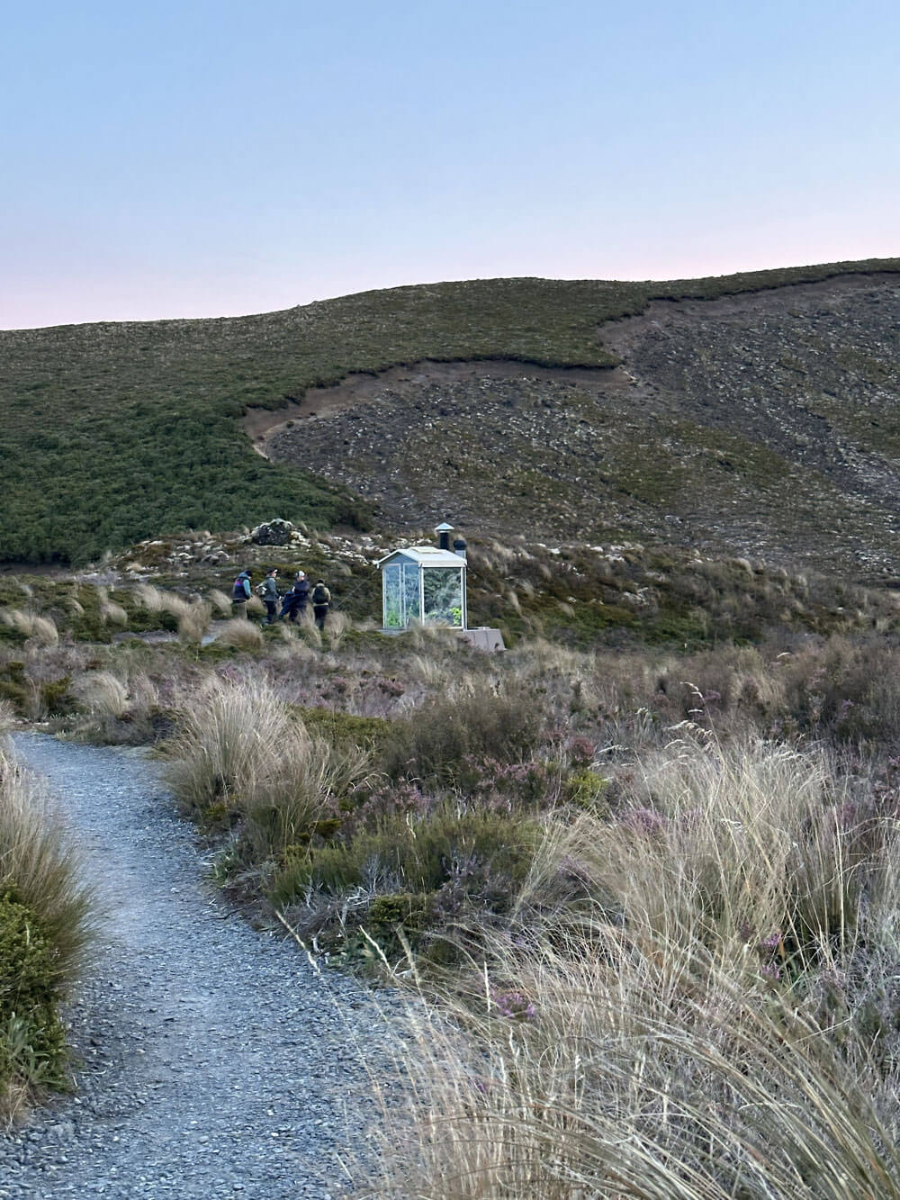
Toilets On The Hike
- Toilets available every 1-2 hours along the track
- Facilities at the start and end of the crossing
- Bring your own toilet paper and hand sanitizer
- There are also toilets at the end of the crossing at Ketetahi.
Rubbish
- No rubbish bins on the Tongariro Crossing
- Take all your rubbish with you – “pack it in, pack it out”
- Embrace the New Zealand ethos: “Be a Tidy Kiwi!”
Transport to the Tongariro Alpine Crossing
- The crossing is a 20.2 km one-way track
- Book a shuttle service for drop off to the start
- Check the dedicated page for detailed transport options and approved operators
Summary of the Tongariro Alpine Crossing
Your Tongariro Crossing journey is a tale of changing elevations and diverse landscapes:
- Start: 1,120 m altitude at Mangatepopo valley
- Highest point: Red Crater at 1,868 metres
- End: 760 m above sea level at Ketetahi road end
Key areas you’ll pass through:
- Mangatepopo Valley: A gentle introduction to the volcanic landscape
- South Crater: A vast, moon-like expanse
- Red Crater: The literal high point of your journey, with panoramic views
- Emerald Lakes: Vibrantly coloured lakes in an otherworldly setting
- Blue Lake (Te Wai Whakaata o Te Rangihiroa): A sacred, cold acidic lake
- Ketetahi Hot Springs area: Steam vents remind you of the area’s geothermal activity
Throughout your hike, you’ll witness the power and beauty of volcanism, from ancient lava flows to steaming vents. The track offers ever-changing views of the surrounding peaks and valleys, creating a truly unforgettable experience.
Remember to tread lightly, respect the cultural significance of the area, and leave no trace of your visit. The Tongariro Alpine Crossing is not just a hike; it’s a journey through one of New Zealand’s most precious natural and cultural treasures.
For a detailed breakdown of the different crossing sections and more in-depth information to help plan your hike, click here.
Embark on this incredible journey across the Tongariro Alpine Crossing, and create memories that will last a lifetime.


